After 30 years, the Public Enterprise Sarajevo International Airport Ltd Sarajevo, developed a new Airport Map and the Map of Aircraft Parking. These maps were improved compared to the previous ones and they comply with the requirements of the International Civil Aviation Organization (ICAO).
The Airport Map and the Map of Aircraft Parking contain very
important information about the Airport and along with other maps and information
about the Airport it is an integral part of the AIP (Aeronautical Information
Publication) and therefore is available for Air Operators. Certain professional
distribution companies as Jeppesen take these maps and publish it worldwide
through its activities. Both cards will be in use from August this year, when
their publication in the AIP is expected.
"The Airport Map is particularly important because it
provides to the flight crew information detailing the ways of Aircraft
movements on the ground starting from the parking position of the Aircraft to
the runway and vice versa" says Elvedin Begic, Acting Executive Director
for Transport and Air Traffic Services. The Airport Map contains a lot of data,
but as particularly important may be singled out:
- reference points of the Airport/ Heliport
- altitude and geoid undulations of threshold / threshold of the runway
- all the runways marked with a number, length and width, capacity of the runway, offset of thresholds, blocking paths and clearings, the direction of the runway, type of surface of the runway, markings of the runway
- all taxiways- with labels, width, lighting, markers (including the position of waiting on the runway and existing central positions of waiting), signs of stopping, other visual means of routing and control, capacity of taxiway or restrictions on the type of Aircraft, where the capacity is less than on the associated runways
- important sites with additional information on objects and devices
- position of observation of visibility along the runway (RVR)
- indicators of tends at visual approach
- lights at approach and the runway

An important change in the updated Airport Map is reflected
in the publication of the length of the so called "DECLARED
DISTANCES", which are calculated from the intersection of runways and
taxiways, as a special importance due to the increasing traffic capacity.
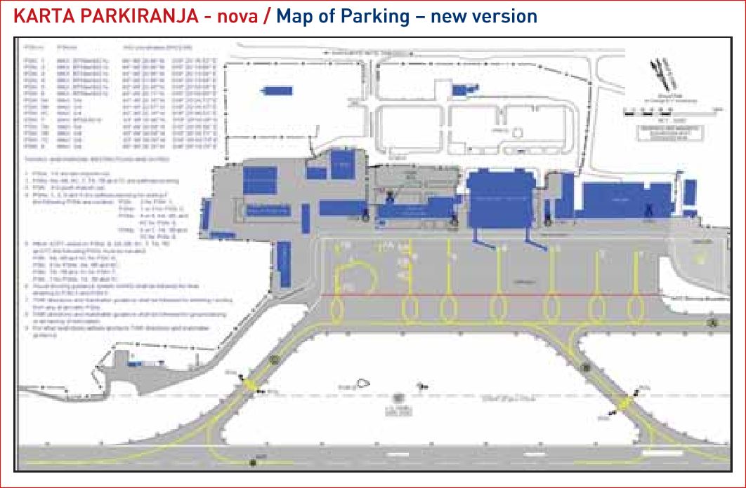
“The Map of Parking contains key data primarily towards
apron (platform) with parking position of the Aircraft, the load of substrate
or restrictions on the type of Aircraft, apron lighting, markings and other
visual and control devices, including the location and type of Visual
Navigation Parking System. Very important data are as well geographic coordinates
for the parking position of the Aircraft, entrance of the taxiway with
markings, including the position of waiting on the runway and the signs of
stopping, "explains CEO Begic. As for the new Map of Parking, reference
points of parking positions and restrictions on the movement of Aircraft
including the rules of parking in certain positions are inserted additionally.
1 comment:
It is really a nice and helpful piece of information. I’m glad that you shared this useful information with us. Please visit my web site carmtransfers.com. Best CARM Transfers service provider.
Post a Comment